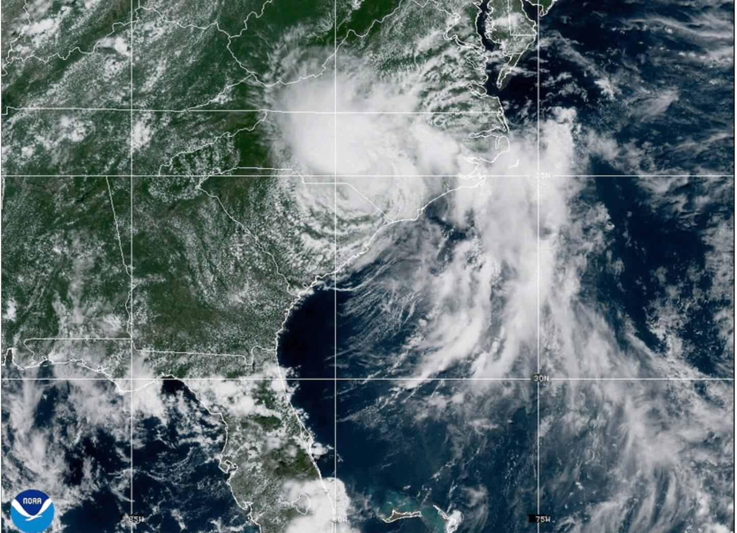
As it moves through central North Carolina and toward south-central Virginia, MIAMITropical Storm Chantal was downgraded to a depression on Sunday, but it still sparked fears about potential flash floods.
At around 4 a.m. EDT on Sunday, Chantal made ashore close to Litchfield Beach, South Carolina, according to the Miami-based National Hurricane Center. It moved north-northeast at 10 mph (17 kph) with maximum sustained winds of 30 mph (45 kph) around 5 p.m., approximately 65 miles (105 km) south-southwest of Raleigh, North Carolina.
As it weakens over North Carolina, the system was predicted to shift more northeast toward the end of Sunday. However, as it gets closer to the Virginia Capes on Monday, it might get a little stronger. With total rainfall of 2 to 4 inches (5 to 10 centimeters) and local amounts up to 6 inches (15 centimeters) that could cause flash floods, flood watches remained in effect through Monday for central North Carolina and south-central Virginia, according to the hurricane center.
For the next few days, forecasters predict that beaches from northeastern Florida to the mid-Atlantic states may experience severe surf and rip currents.